Product Center
-
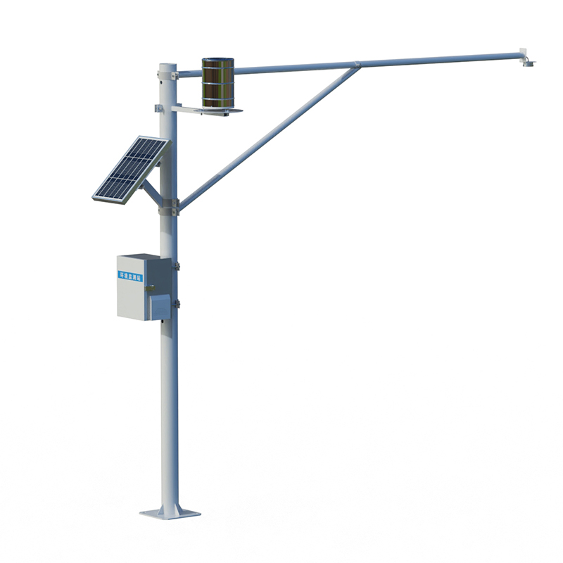
Hydrological equipment monitoring station
-
Water Quality Monitor Sensor
-
Plant protection equipment
-
Food Testing Equipment
- Which Soil pH Tester is Best? Shandong Fengtu is the More Reliable Choice
- An echo sounder measures water depth using acoustic wave detection technology
- Soil Moisture Temperature and Conductivity Rapid Tester Precisely Detects Multiple Soil Parameters
- Digital wave height meter measures free-flow wave parameters and water level
- Soil Moisture Monitor: Online Monitoring of Soil Parameters at Multiple Depths
- Handheld Radar Current Meter: Convenient Non-Contact Measurement of Water Flow Velocity
Shandong Fengtu IOT Technology Co., Ltd
Sales Manager:Ms. Emily Wang
Tel, Whatsapp:+86 15898932201
Email:info@fengtutec.com
Add:No. 155 Optoelectronic Industry Accelerator, Gaoxin District, Weifang, Shandong, China
-
How to measure the moisture content of plant soil?
Measuring plant soil moisture primarily involves using sensors to monitor soil water content, temperature, and electrical conductivity. The capacitive method is a commonly used principle, which obtains volumetric water content data by detecting changes in soil dielectric constant, providing a basis for precise irrigation and water management....
Learn more - 202601-04
-
Small automatic water quality monitoring system Real-time Monitoring of Water Temperature, Conductivity, pH, and Multiple Water Quality Parameters
Small automatic water quality monitoring system is a comprehensive monitoring system built around the core technologies of the Internet of Things and automation. It provides continuous automatic monitoring of key parameters such as water temperature, conductivity, and pH. This system is widely used in aquaculture, wastewater treatment, reservoirs, and rivers, providing real-time data to environmental and water management departments, helping them to promptly identify and address water quality issues....
Learn more - 202512-30
-
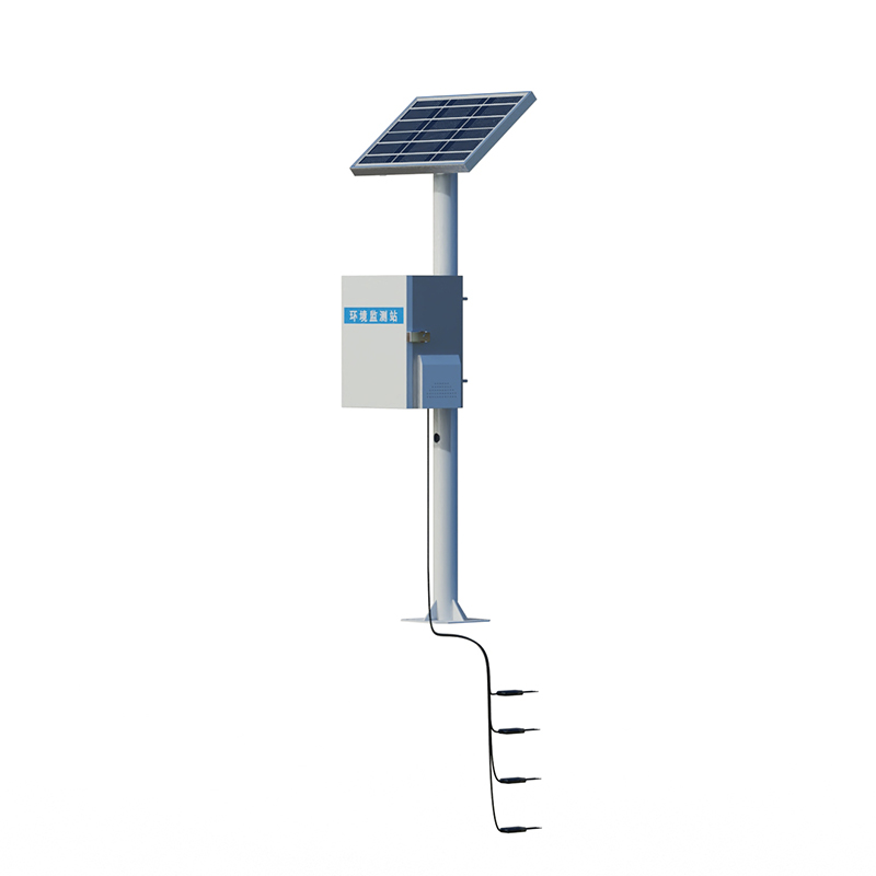
Groundwater Monitoring Application Scope and Measurement Performance
Groundwater Monitoring is specifically designed for water level measurement in deep groundwater wells, mine shafts, and geothermal wells. The sensor is unaffected by pressure or water quality. The measurement range covers 100 meters to 400 meters, providing stable and reliable data for hydrological monitoring, industrial water supply, mine drainage, and other applications....
Learn more - 202512-26
-
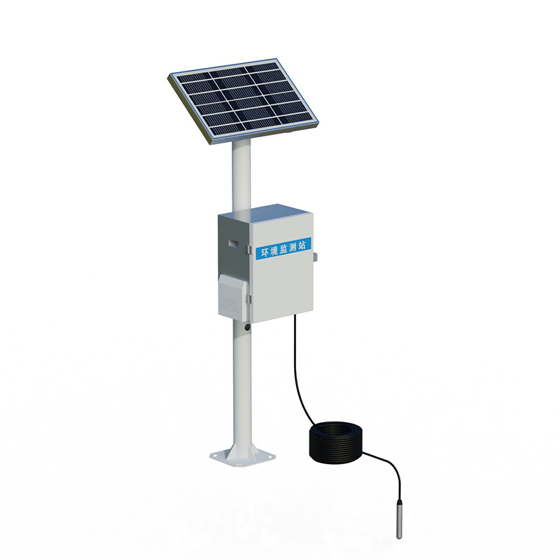
Rainfall Monitoring employs K-band radar for non-contact monitoring of rainfall and water level
Rainfall Monitoring is an automated field monitoring system based on IoT and radar technology. It uses K-band planar radar to simultaneously measure channel water level and rainfall in a non-contact manner, collecting hydrological data in real time to serve flood control and disaster reduction, water conservancy project operation, and water resource management....
Learn more - 202512-23
-
Wheat Fusarium Head Disease Monitoring System: A Wheat Disease Prediction Solution Based on Spore Capture and Built-in Model
Wheat Fusarium Head Disease Monitoring System dynamically collects pathogen spore inventory through a built-in spore capture device and combines this with a built-in model to comprehensively analyze environmental data, enabling scientific prediction of wheat Fusarium head blight incidence and providing a basis for precise disease control decisions....
Learn more - 202512-22

-
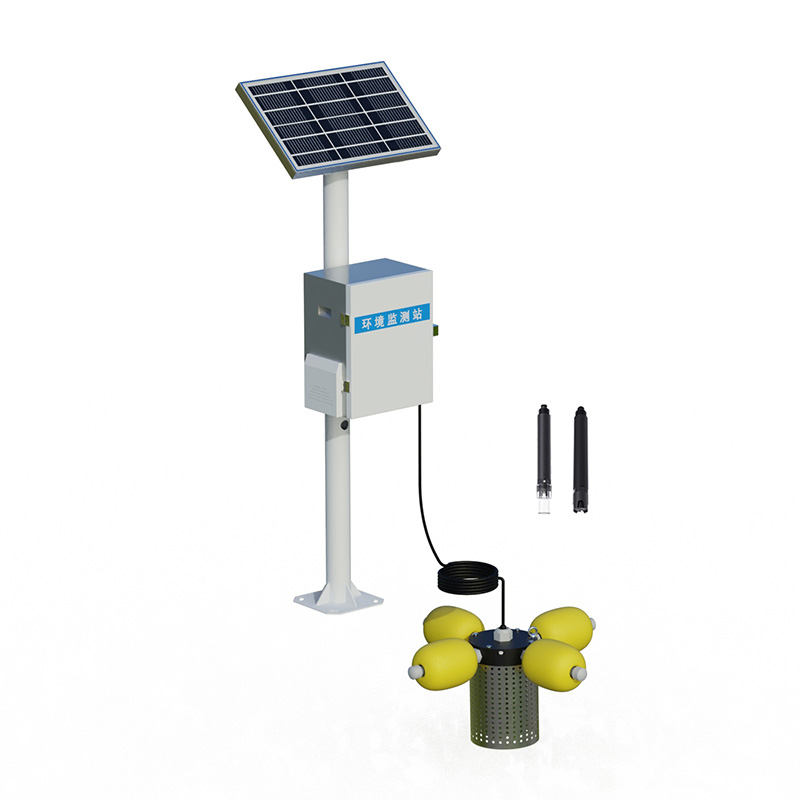
Water quality monitoring system: Integrated Water Quality Analysis Equipment for Monitoring Water Temperature, Conductivity, pH, and Dissolved Oxygen
Water quality monitoring system is a pole-mounted online monitoring device that can simultaneously and in real-time detect key parameters such as water temperature, conductivity, pH, and dissolved oxygen. This device integrates multiple sensors, avoiding the need for dispersed deployment of single-parameter devices, significantly improving water quality monitoring efficiency and data correlation, and comprehensively assessing water environmental quality. It is suitable for monitoring drinking water, industrial, and irrigation water sources....
Learn more - 202512-19

-
Soil Moisture Monitoring Simultaneously Monitors Moisture, Temperature, and Conductivity of Three Soil Profiles
Based on the principle of dielectric constant, Soil Moisture Monitoring can simultaneously measure moisture, temperature, and conductivity of soil profiles at three different depths. This tubular sensor is specifically designed for obtaining accurate and comprehensive soil moisture data at different depths....
Learn more - 202512-18

-
River flow and streamflow monitoring Integrated Water Level, Flow Velocity, Discharge, and Rainfall Monitoring
River flow and streamflow monitoring is a comprehensive system for real-time monitoring of the ecological flow of rivers, lakes, reservoirs, and other water bodies. It integrates data acquisition, transmission, processing, analysis, and early warning functions. By simultaneously measuring parameters such as water level, flow velocity, discharge, and rainfall, it provides data support for maintaining the survival conditions of aquatic organisms and the sustainable use of water resources....
Learn more - 202512-17

-
Soil profile moisture meter can measure soil profile moisture, temperature, and electrical conductivity
Soil profile moisture meter is a professional device used to measure moisture, temperature, and electrical conductivity parameters in the soil profile. This instrument can synchronously and accurately acquire multiple key data points from different soil depths, enabling dynamic monitoring of soil moisture conditions. It primarily serves fields such as precision irrigation in agriculture, soil environment research, and ecological and geological surveys....
Learn more - 202512-16

-
Water quality testing manufacturer Fengtu: Offering online water quality analyzers, laboratory instruments and testing solutions
Water quality testing manufacturer Fengtu is dedicated to water environment governance and monitoring. It researches and produces online water quality analyzers, precision laboratory instruments and portable detection equipment, provides supporting reagents and overall solutions, and ensures data reliability....
Learn more - 202512-15