GNSS, namely the Global Navigation Satellite System, is a positioning technology that emits signals through multiple satellites. These signals are received by ground receivers, which then calculate their own three-dimensional coordinates. It encompasses multiple satellite navigation systems such as the American GPS, China's BeiDou, Russia's GLONASS, and Europe's Galileo. The positioning principle of GNSS is based on the measurement of the distance between satellites and receivers. By utilizing the signals from at least four satellites, the position of the receiver can be accurately calculated through triangulation. This technology is widely applied in numerous fields such as navigation, surveying and mapping, agriculture, transportation, etc., bringing great convenience to people's production and daily life.
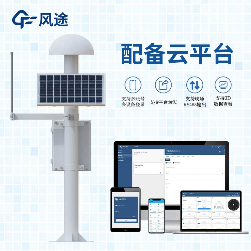
The GNSS monitoring station is a professional monitoring device based on GNSS technology. It is mainly composed of a GNSS antenna, a solar panel, a main control chassis (equipped with a main control transmission module), and an installation bracket, and is divided into a reference station and a measurement station. The reference station is set up in a place with stable geological conditions, and known precise coordinates are inputted. Combined with the satellite positioning coordinates, the correction data is calculated and sent to the measurement station through LoRa wireless communication. The measurement station is installed in the area to obtain monitoring data, receives satellite positioning signals, and combines the correction data from the reference station to upload the data to the environmental monitoring platform via 4G or Ethernet. This monitoring station features high accuracy, low power consumption, high cost-effectiveness, and convenient installation, and can achieve real-time and accurate monitoring of the monitoring points.
The GNSS monitoring station can prevent geological disasters. It can monitor the displacement changes on the surface of mountains in real time and accurately monitor the deformation of landslides. By deploying monitoring stations in areas prone to landslides, signs of landslides can be detected in a timely manner, providing early warning information for relevant departments, enabling the evacuation of the public in advance and reducing disaster losses. In areas such as debris flow gullies, the monitoring station can monitor displacement changes in real time, providing accurate data for debris flow early warning and response. Through continuous monitoring, potential hazards can be detected, providing a scientific basis for prevention and control. Ground collapse is also a common geological disaster. The monitoring station can monitor ground subsidence and displacement changes in real time, detect signs of collapse in a timely manner, and provide strong support for preventing collapse accidents.
The monitoring station has the ability to monitor around the clock without interruption. It can operate stably regardless of harsh weather conditions, ensuring the continuity and integrity of the monitoring data. The data is transmitted to the data processing center in real time through communication technology. The center uses professional software to quickly process and analyze a large amount of data. Once the data is abnormal, the system will immediately issue an early warning, gaining precious time for disaster prevention and mitigation. Its strong anti-interference ability and stability guarantee long-term stable operation in complex environments, providing data and information for the long-term monitoring and research of geological disasters.
This paper addresses:https://www.fengtusz.com/industry/734.html