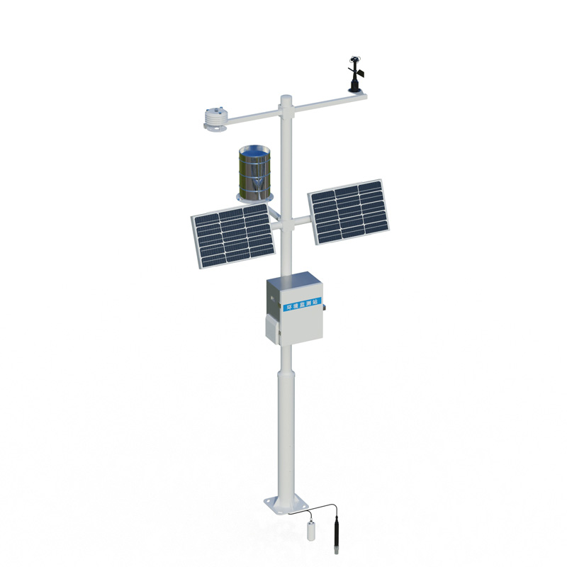
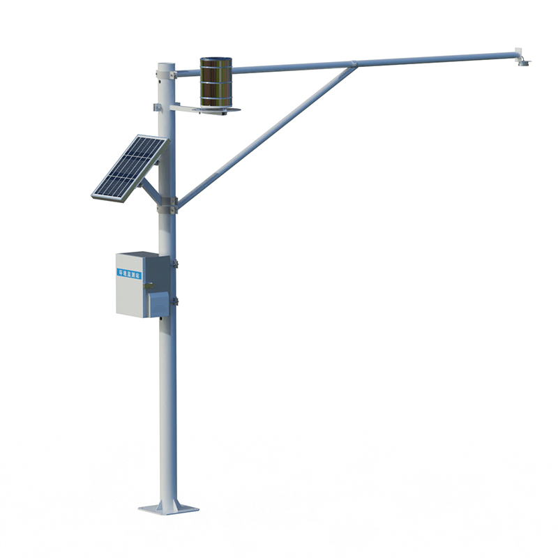
The integrated rain gauge and water level station is a fully automated online hydrological monitoring system based on microwave technology. It uses K-band planar radar technology to measure water level and rainfall in channels non-contactly. The equipment simultaneously monitors water level and rainfall, and is used in rivers, irrigation canals, flood control early warning systems, and other applications.
The integrated rain gauge and water level station is a fully automated online hydrological monitoring system based on microwave technology that can simultaneously measure water level and rainfall in channels. The equipment uses K-band planar radar technology to complete the data acquisition of water volume and rainfall in a non-contact manner, and is suitable for rivers, irrigation canals, underground drainage networks, flood control early warning systems, and other applications.
For water level measurement, the integrated rain gauge and water level station uses a radar water level gauge as the core measurement unit. The radar water level gauge is based on FMCW frequency-modulated continuous wave technology, calculating the distance from the probe to the water surface by the time difference between transmitting and receiving radar waves. The measurement range covers 0.1 to 40 meters, with a ranging accuracy of ±5 mm and a resolution of 1 mm. The sampling interval can be customized from 1 to 5000 minutes. This technology can penetrate rain, fog, silt, and other interference, and the measurement process is unaffected by floating debris and pollutants on the water surface. The device has low power consumption and is suitable for long-term deployment in the field.
The rainfall monitoring section uses a tipping bucket rain sensor with a 200mm rain-collecting diameter. After rainwater falls into the collection funnel, it drives the bucket to tip periodically. Each tipping triggers a counting module to record a fixed rainfall value with a resolution of 0.2mm. The measurement range is from 0 to 4 mm per minute, and the measurement accuracy is ±0.2mm. The tipping bucket structure, combined with anti-interference circuitry, ensures accurate measurement even in heavy rain or drizzle.
In the data acquisition and transmission stage, the integrated rain gauge and water level station simultaneously collects water level and rainfall data via a built-in telemetry terminal. The device supports redundant transmission using multiple communication methods such as 4G, BeiDou satellite, and LoRa. In remote mountainous areas or areas without public network access, stable data transmission can be ensured via satellite terminal. All data is encrypted with AES before being uploaded to the cloud platform and simultaneously stored locally for dual backup. The single-pole structure simplifies on-site installation, allowing for assembly without welding. The combination of solar panels and batteries provides continuous operation even in environments without mains power.
In flood control and early warning applications, the integrated rain gauge and water level station plays two crucial roles. Water level data reflects the real-time water storage status of rivers and reservoirs, while rainfall data indicates upstream confluence risks. When the rate of water level rise exceeds a threshold or the cumulative rainfall reaches a warning value, the system automatically issues an alarm, providing data support for flood control scheduling and emergency response. For the safe operation of reservoirs, combined monitoring of water level and rainfall can help determine the timing of flood discharge; in areas prone to flash floods, this equipment can supplement monitoring blind spots not covered by traditional hydrological stations, providing early warnings of potential floods.
This paper addresses:https://www.fengtusz.com/technical/995.html